WRI researchers will use spectrometry to map the health of key Wisconsin wetlands.

Credit: Provided photo
June 30, 2017
By Aaron R. Conklin
You’ve likely heard of fens, a particular type of miry and mineral-rich wetland, in the context of European geography or literature. Shakespeare referenced fens in “King Lear,” and J.K Rowling included them in the Harry Potter universe. (They were reportedly the home of Salazar Slytherin, in case you were wondering).
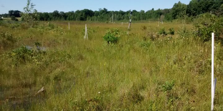
But fens aren’t fictional—they’re real, and they’re right here in Wisconsin, in the glaciated parts of southeastern and south central regions of the state. They’re home to several rare and important plant species—think sedges and orchids–and they’re an important sentinel indicator of overall environmental health.
That’s why a team of researchers, led by University of Wisconsin-Madison hydroecologist Eric Booth, is spending much of the summer using both partial and full-range imaging spectrometers to get a detailed look at the health of two sets of fens in Wisconsin—three pristine. and three degraded by the nearby presence of wells. Their work is backed by the University of Wisconsin Water Resources Institute.
The team’s research is back-dropped by the ongoing debate over new high-capacity well applications in Wisconsin. The Wisconsin Department of Natural Resources is looking for tools to help efficiently and effectively evaluate the wells’ potential effect on fens and other wetlands. Spectrometry, which delivers images that can suggest the levels of nutrients like phosphorous and nitrogen in plants, has the potential to be one of those tools.
“What’s needed is a good model that can accurately estimate the impact,” said Booth. “There’s just not a ton out there in terms of evaluating the impact to an ecosystem that depends on groundwater.”
And fens most definitely depend on groundwater—more specifically, groundwater with an unique water chemistry that’s high in carbon and calcium, but low in the nitrates and phosphorous that typically dominate wetlands that experience greater amounts of runoff from sources such as agriculture. Changes in the groundwater level or chemistry caused by well pumping or other environmental changes could have devastating effects on the fens.

Credit: Eric Booth
The research team will gauge the health of the fens from three angles. They’ll attach the spectrometer to a plane and conduct a series of low-altitude flyovers to capture high-pixel images that convey biochemical information about the plants in the fen. On the ground, they’ll collect and data-sample leaves from the fen to compare the plant chemistry to the images they collect. And they’ll also use handheld spectrometers on the ground to offer a second, on-the-ground view of the fen’s plant life.
Booth and the rest of the team will rely on the remote-sensing lab of Phil Townsend, a UW-Madison professor of forest and wildlife ecology, to interpret the results. The tool they’ll be using, purchased by the UW as part of its 2020 Research Project, can capture detailed images and chemical signatures beyond the near-infrared and visual spectrum, the traditional range plant ecologists have studied.
“We hypothesize that the fens will be low in nutrient concentrations like phosphorous and nitrogen,” said Booth. “Our idea is that nutrient concentration changes can be sensed in the vegetation. We’re using vegetation as an indicator to changes in the groundwater regime.”
The research team conducted its first flyover in June, and will conduct two more before summer’s end. The on-the-ground work will occur throughout the summer. Booth is aware that the biggest challenge will be successfully relating the high-resolution images the spectrometer collects to the plant chemistry information his team will gain in the lab.
“When we’re done, we’ll have a continuum of images from un-impacted to impacted,” he said. “Hopefully we will see some striking contrasts that can then be used as a means of mapping a fen’s status. That gives you the ability to go back and easily redo area surveys to check on the health of a certain fen.”


